
BARADX : Track your Satellite
The TTC Dashboard for BaradX
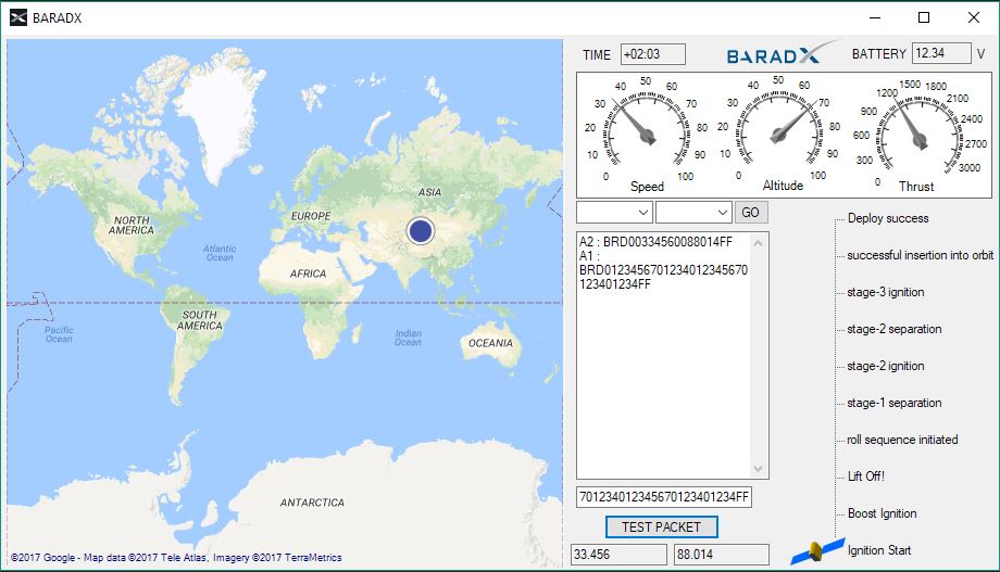
Presently,
• Get input packets from two Arduinos
• Put the respective parameters in the corresponding fields
• Plot the latitude-longitude using the Maps API GMaps, OpenStreetMap, BingMaps
• Display gauges and bars
• Watch your satellite navigate across the globe
Find the GitHub repo here.